
Walk 34 - Happy Valley - Moderate Route
Distance: 4 miles (6.4 km)
Maps: Explorer OL16
Walking time: 2 hours
Start: Carey Burn Bridge (grid reference - NT976250). If you are heading north up the A697 head towards Wooler Town Centre. Take the first left and follow signs for Harthope Valley. As you enter the valley you rise up and drop steeply into the valley. As you drop down you will see some car parking spaces just before the road bridge taking you over the Carey Bury
DOWLOAD a PDF of this walk with a map from here.
Summary
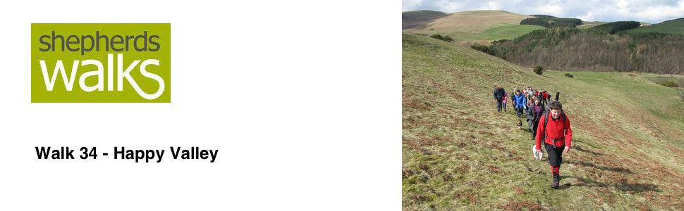
This lovely short walk explores one of the most picturesque areas of the Cheviots, Happy Valley. It is not too demanding so gives everybody a real taste of walking in The Cheviots.
Route Details.
From your car walk towards and cross the road bridge taking you over the Carey Burn.
This current bridge was built in 1956 after the previous one had been washed away in the floods on 1948. After all the bad weather we have had in the last decade this current bridge has certainly proved itself.
After crossing the bridge turn left and cross the stile (signpost saying – Public footpath, Middleton Old Town 1 ½, North and South Middleton 2). As you walk in the direction of the yellow arrow you will reach and cross a small wooden footbridge.
Follow the narrow footpath as you climb up with the burn down to your left.
You reach and cross a stile, just before a corner in the fence on your right. Continue walking in the same direction you where walking previously, ignoring the path going up to your right, as you pass a marker post.
Continue to follow the path through the open ground, cross a small burn and bear slightly to your right as you rise up, with the ground rising up on the right with some Gorse bushes and the ground dropping away on your left to a small lake.
You will reach and pass over a stile, and then cross a small footbridge before going over a single strand of barbed wire. Follow the yellow way marker directing you off to the left and continue to rise up, passing another yellow way marker and walking in the direction of the yellow arrow. You will reach the top of the hill, littered with rocks.
Continue walking over the summit and you will drop down to a well-trodden grassy track. Bear right along it, so you have the fence on your left and the river in the bottom of the valley. Continue to follow the well trodden path cut into the hillside, which will be surrounded by bracken during the summer months.
You then reach the corner of a wood with a way marker post. Turn left and walk along with the wood on your left. After a little while continue to follow the path as you lose the wood on your left hand side, but continue to run parallel to the fence up to your right hand side.
Pass over a stile, located to the right of a wooden gate with a wood on your left. Continue along with the wood on your left for a short while before you reach and cross another stile located to the left of another large wooden gate.
Walk in the direction of the yellow arrow pointing down to a gate in the far left hand corner of the field. As you cross the field you have the remains of ‘Middleton Old Town’ up to your right.
Middleton Old Town is the deserted medieval village of North Middleton. There are some ruins still standing. Old documents suggest this is the village of North Middleton, although it was originally called Midilest Middleton when first mentioned in 1242. In 1296 there were eight taxpayers and in 1580 there were eleven tenants living here. The settlement probably moved at the end of the C18th and only a few buildings were left standing here by about 1800.
As you continue on you reach and cross over a stile, which is located to the right of a small wooden gate. You then drop down and cross a small footbridge before rising up steeply to a stile located to the right of a small gate. Cross this stile and bear left along the broad farm track before reaching and passing through a large wooden gate which is located at the end of a stone wall.
Continue along the farm track with a fence on your left and grass fields rising up on your right.
The track you are following starts to drop and you cross over a stile located next to a large gate. You continue to drop down with a fence initially then a wall on your left as you drop down to North Middleton. You reach and pass through a large metal gate and turn left along the single track road.
On your left you pass some sheep pens, just before you reach the farm. Sheep pens are used to gather the sheep into so the shepherd can work on them. The tasks carried out on the sheep will vary according to the season, but could be things like worming the ewes and lambs, trimming their feet and marking them in case they manage to escape onto your neighbours ground.
As you continue on you pass North Middleton farm with its distinctive red doors and as you follow the single track road you have cottages on both sides.
As the road starts to drop down ignore the footpath going off to your left (Haugh Head) and continue to follow the single track road down to the ford. Cross the river using the footbridge to the left of the ford and then turn immediately left through a small kissing gate.
Follow the path through the woods, with the river on your left and the path rising up before dropping back down to the valley floor. This section through the woods can be very pretty early in the spring when the Bluebells are out.
You reach and pass over a stile located to the left of a large wooden gate and continue walking in the direction you where previously as you pass through the middle of a field, with the ground rising up to the right and a fence away to the right, with the river the far side of it.
The stile you are heading for is in the far right hand corner of the lower section of the field you are walking through.
As you pass through this field look up to the higher ground on the left, which is the area you walked through on the outward part of this walk, but now on the return trip you are passing through ‘Happy Valley’.
Happy Valley got its name from the ladies of Middleton Hall, who used to walk the valley in the 19th century. I personally think it is one of the prettiest areas of the Cheviot Hills.
You reach and pass over a stile in the corner of the field located to the left of a large gate. Continue along the prominent track, with a fence on your right with the wood behind it and Gorse bushes on your left.
Follow the path as it bears to the left, cutting off the corner of the field where you will reach and pass a way marker in the middle of the field. Ignore the path going off to your right, but continue walking in the same direction you were previously, heading towards the Gorse bushes.
The prominent path rises up through the Gorse bushes, before dropping back down to the valley floor. Cross the small bridge, with a pipe under it and continue along the valley floor, with the fence on your right.
You reach and pass through a large gateway and continue to follow the prominent path. The path opens up a little, with some gorse bushes on your left and the road on you right. Cross the field heading for the tall post, which is located next to the stile.
Cross the stile and turn left along the road. This takes you back to your car.